The Wild Country

The Wild Country

Ireland has designated its first national wilderness: a vast area of mountain, bog and forest on the country’s wild west coast. But is a real ‘backcountry’ experience possible on such a small island?  

The Great Outdoors magazine, December 2013

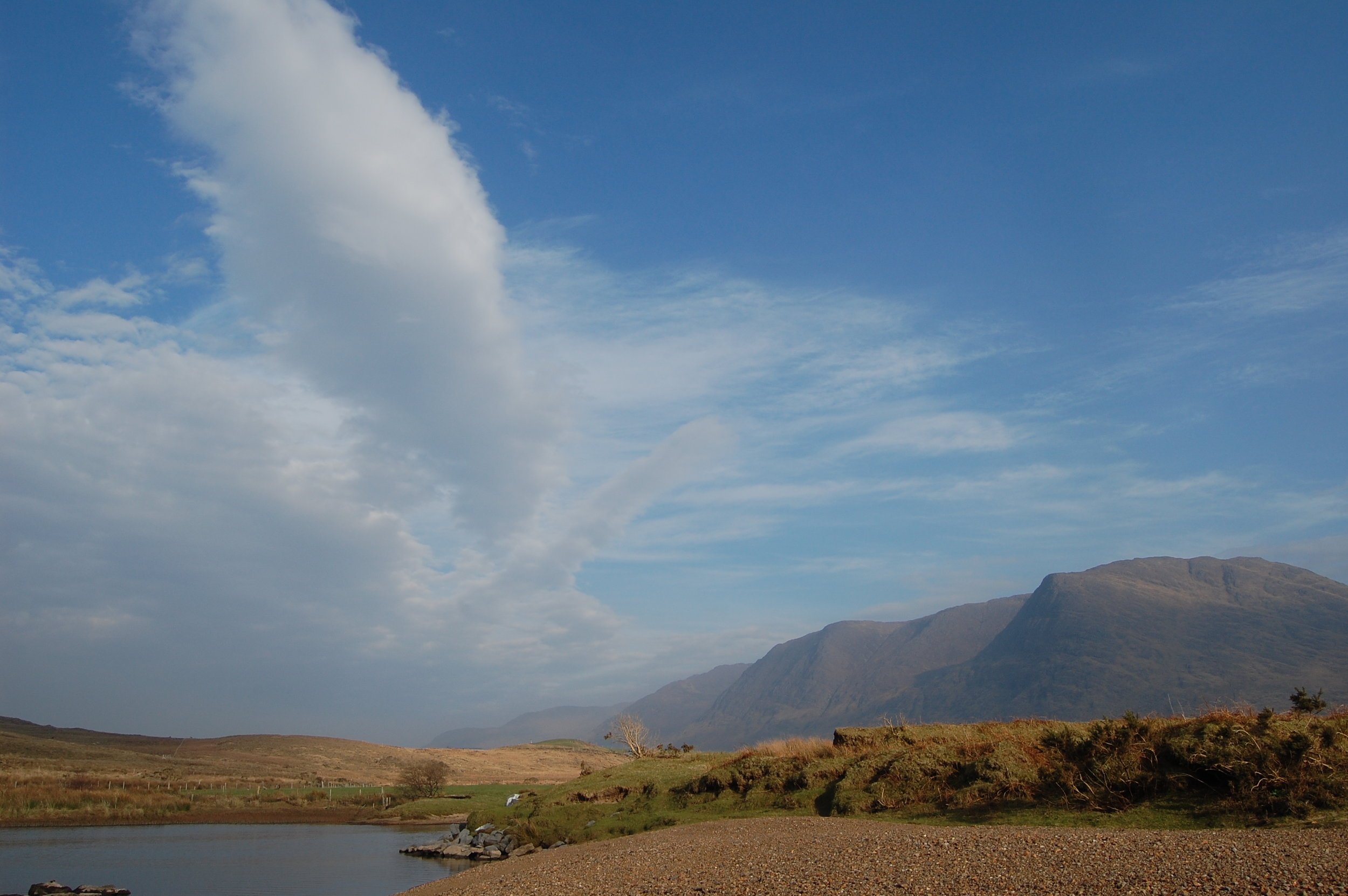
You won’t meet many other walkers in the Nephin Beg mountains. You can kind of understand why. Only two of these hills peep over 700 metres, they get about four times as much rain as Dublin, and they’re a long way from most places.

But these hills guard the wildest terrain in Ireland. In 1937 – after 5,000 miles of walking through Ireland – the naturalist Robert Lloyd Praeger wrote: “Indeed the Nephinbeg range of mountains is I think the very loneliest place in this country, for the hills themselves are encircled by this vast area of trackless bog. Where else even in Ireland will you find 200 square miles which is houseless and roadless...”

The Nephin Begs rise to the north of Clew Bay in County Mayo. West of their central spine is the immense Owenduff blanket bog; to the east are huge conifer plantations. The only roads out here are forest tracks. In March, Ireland’s national parks service, together with the state forestry company Coillte, designated 11,000 hectares of this landscape as Ireland’s first national wilderness area: Wild Nephin.

Read More

Ireland’s big rewilding project first of its kind in Western Europe

Wild Nephin project aims to create 27,000 acres of unique wilderness landscape

Earth Island Journal, October 16, 2013

The Nephin Beg mountain range rises on Ireland's western coast and stretches 20 miles into the sparsely populated northwest of County Mayo. This is a landscape of boglands and heath-covered mountains, battered by Atlantic winds and rain. The only forests here are stands of Lodgepole pine and Sitka spruce, planted in an attempt to wrestle economic gain from the unproductive soil.

On a long coastline of wet, weather-beaten hills, the Nephin Begs aren't unique. But they form one of the few big areas of roadless, uninhabited terrain in Ireland.

Now this range is home to a pioneering re-wilding project. In March, Ireland's National Parks and Wildlife Service, and Coillte, a public forestry company — the region's two big landholders — designated 27,000 acres of bog, mountain, and forest out here as Ireland's first wilderness area, Wild Nephin.

The project has three core aims: to protect a large wild landscape, re-wild the forest, and provide a "primitive" wilderness experience for visitors.

Over the next 15 years the project will aim to "naturalize" the plantations. It will thin the forest cover to let more light into the understory, create more clearings, restore areas of bogland, and plant some native species. Trees will be felled but left in place to mimic natural catastrophes and encourage regeneration. Forest roads will be closed and converted to trails.

While many conservation areas in Ireland are utilized in some way — often for sheep and cattle grazing — Wild Nephin will seek to create a wild, "self-willed" landscape. "What we want to do over the next 15 years is re-engineer the forest, so in 15 years time when we step out of the management of the area, then only wild processes will change the landscape," says Wild Nephin project manager Bill Murphy.

The region is not yet a perfect wilderness. In 2002, Ireland was prosecuted by the European Commission for allowing part of the region to be overgrazed by sheep (stocks have since been reduced). The Nephin forests also bear the scars of past logging. The re-wilding project will not seek to remove the non-native conifers that dominate the forests; instead it will encourage natural regeneration.

The Wild Nephin project is part of a loose but growing movement to create and protect wilderness across Europe, and to re-wild ecologically degraded landscapes. Germany, for instance, is aiming to designate 2 percent of its land area as wilderness by 2020.

The nonprofit Rewilding Europe aims to rewild one million hectares of land by 2020 and create 10 “magnificent” wildlife and wilderness areas. The group hopes its efforts “will serve as inspirational examples of what can also be achieved elsewhere.” Another organization, Pan Parks, also plans to safeguard one million hectares of European wilderness by 2015. Pan Parks oversees a network of wilderness areas, including mountainous regions in Eastern Europe, an island archipelago in Finland, and forests and boglands in Estonia and Lithuania. All these areas are within existing national parks, but must now satisfy the Pan Parks' definition of wilderness, which prohibits logging, hunting, fishing, agriculture, roads or construction in designated areas.

Earlier this month, the World Wilderness Congress was held in Salamanca, Spain — the first time in 20 years Europe hosted the event. Wilderness groups published a document, A Vision for A Wilder Europe, calling for the continent's last wilderness areas to be protected, and for natural processes to be allowed shape more of Europe's land.

"If we can get people behind our cause, then we can say that no more wilderness is going to be lost in Europe," says the Pan Parks' executive director Zoltan Kun.

The term re-wilding is often used to describe the re-introduction of big, locally extinct species — like the gray wolf in the United States’ Yellowstone National Park. But in reality it often means less eye-catching projects like Wild Nephin, which aim to restore landscapes and allow wild processes to take over. And indeed, iconic species of bear, lynx and wolf are all making a comeback across Europe.

"Wilderness probably wasn't even on the European radar in philosophical terms if you go back 20 years," says Toby Aykroyd of the Wild Europe Initiative, an alliance of conservation and wilderness groups. But that has changed. Momentum for rewilding stems from a 2009 motion passed by the European Parliament that called for more wilderness protection, and for wilderness to be defined and mapped. Last year the European Commission published a biodiversity strategy that mentioned wilderness for the first time.

However, most of the wilderness that remains in Europe is in the east of the continent. In densely populated, urbanized Western Europe, little land is truly wild. In Ireland even the most remote mountain valleys provide grazing for sheep, while in the UK national parks protect cultural landscapes as much as wild ones, with villages and farms inside their boundaries.

"Wilderness is not a word you'll find in all European languages, so it's very difficult for there to be a common literature or history [of wilderness preservation]," says Mark Fisher of the Wildland Research Institute at Leeds University, UK.

In this, Europe differs from the United States, where the writing of early wilderness advocates —from John Muir to Aldo Leopold and Edward Abbey —seems to have taken root in the national psyche.

"If you look at the history of protected areas in America... there was a movement to protect areas of huge scenic quality," Fisher says. In Europe, however, early conservation movements were science-driven, he says. They aimed to protect landscapes where important species and biological communities thrived. And because of that, an emotional response to wild places never became embedded in European culture, Fisher says.

The idea of rewilding areas in a continent where the human imprint is so large, has set off a debate over best conservation practices. Earlier this year, the British writer and environmentalist George Monbiot provoked heated discussion with his latest book Feral: Searching for Enchantment on the Frontiers of Rewilding, and a series of articles that took a pointed look at the aims of conservationists. Monbiot criticized UK conservationists for their "intensive management of the natural world".

"Nowhere else does conservation look more like a slightly modified version of the farming which trashed the land in the first place," he wrote in a column on the Royal Society for the Protection of Birds website. Monbiot believes rewilding should involve reintroducing missing animals and plants that were once native to a region, and abandoning “the biblical doctrine of dominion” that assumes it is our duty to “control and corral” nature. "In my view most of our conservation areas aren’t nature reserves at all. They are museums of former farming practices, weeded and tended to prevent the wilds from encroaching," he writes.

Even groups that aren’t pushing as hard for species reintroduction agree that conservation efforts in Europe have been too focused on preserving individual species and habitats rather than whole dynamic ecosystems. "I think traditional conservation has got stuck in a rut around a kind of gardening ethos," says Toby Aykroyd of the Wild Europe Initiative.

But campaigners seem to be chipping away at this thinking. The Wild Europe Initiative includes big conservation groups such as Birdlife International, UNESCO, and the WWF. The European Commission recently commissioned the production of guidelines for "non intervention" management of wild areas, and an official register of wilderness in Europe is in production.

The Wild Nephin project was recently the centerpiece of a major conference, held in Irish town of Westport, on wilderness in modified landscapes. Inherent in this theme was the acceptance that, in Western Europe, wilderness will have to be created by rewilding habitats that have been modified by humans.

"The whole idea of wilderness in Europe is going to be different from the idea of wilderness in North America," says Wild Nephin’s Bill Murphy says. "We have to come up with a context that suits our culture."

Zultan Kun of Pan Parks believes that ultimately, there's a moral obligation —both to the developing world and to future generations — to protect wild land in Europe. "We always talk about protecting the Amazon rainforest, or protecting Borneo. And while we argue for that we destroy our nature here," he says. Kun stresses the difference between rewilding and restoring wilderness — you could rewild your city garden, but you won't get a wilderness.

These are still early days for the wilderness movement in Europe. While Pan Parks might be one of Europe's biggest wildland advocacy groups, Kun told me the group employs just four people who all work from home. He was working from his daughter's bedroom when we spoke.

Kun dreams of turning 5 percent of Europe into protected wilderness. Right now an estimated 1 percent of European land is wilderness, and another 1 percent is near-wilderness that requires restoration.

But environmentalists see the potential to drastically increase this, partly due to high levels of land abandonment across Europe. And Kun believes that as economic recession dries up funding for conservation in Europe, the political environment could favor a more hands-off approach to managing protected areas.

"We have the favorable political environment to take wilderness further, but we need to create massive public support for it," he says.


Restorative ramble

A stroll through one of Co Dublin’s oldest woodlands

Irish Times, Sept 14, 2013

There’s so little old woodland in Ireland it feels like an exotic habitat. Trees once covered our island, but today walking in woods is a novelty compared to walking on hills, beaches or bog. I was browsing a study of ancient Irish woodlands recently, hoping to discover those last places this primeval landscape survives and came across one listing for Dublin: St Catherine’s Wood, Lucan.

One Sunday evening in late July, I caught a train from Connolly station to Leixlip Confey and walked to St Catherine’s. The sun was coming out after a heavy downpour and a rainbow formed over a field where highland cattle grazed. This hardy, mountainous breed was introduced here last year to improve meadow biodiversity. The cattle will graze and trample some parts of the field more than others, encouraging a wider range of plants to grow.

The old wood is just inside the Dublin county border. St Catherine’s gets its name from a priory founded by Warisius de Pech here in 1219. At the time it was considered the duty of Anglo-Norman lords to establish religious foundations to save their souls and those of their ancestors.

Over the centuries the estate passed between different owners. Trinity College pharmacy professor Christopher O’Connor owned the lands in the 1940s and 1950s. He grew exotic plants such as poppies, carnations and deadly nightshade, which were sent to a pharmaceutical plant in Tipperary, according to an article by local historian Mary Mulhall in the Lucan Newsletter in 2012.

The OPW bought the estate in 1996.

My walking buddy and I followed the path into the woods which sit on a steep glacial ridge above the Liffey. The canopy here is dominated by ash and beech. The latter was introduced to Ireland in the 16th century. There’s plenty of sycamore here too, but only the odd oak.

Some rare woodland plants recorded at St Catherine’s suggest this wood may be ancient. The naturalist Robert Lloyd Praeger found the yellowbird’s nest plant here in 1934, although it hasn’t been seen since. More recently the common toothwort was recorded.

We took a side trail down to the remains of an old sluice gate, where the Liffey is squeezed through a narrow gap in a torrent of whitewater. A kayaker was play- boating in the rapids. We startled a heron on the riverbank and watched a woodpigeon drink from the water.

Then we rejoined the main path and climbed to the upper woodland, following the trail back towards the cattle field and out of the woods.

Our stroll left me thinking that even though there are too few of them in Ireland, woodland walks always provide the most restorative kind of ramble.

Robert Louis Stevenson, in one of this travel essays, wrote: “It is not so much for its beauty that the forest makes a claim upon men’s hearts, as for that subtle something, that quality of the air, that emanation from the old trees, that so wonderfully changes and renews a weary spirit.”


At one with wilderness

Hiking Ireland's first wilderness area

Irish Times, August 17, 2013

We simply need that wild country available to us,” the US novelist and historian Wallace Stegner wrote, “even if we never do more than drive to its edge and look in.” This is an arresting idea: that wild places nourish our spirit even if we never enter them.

If there is true wild country anywhere in Ireland, it’s in the Nephin Beg mountains of north-west Mayo. In March, Coillte and the National Parks and Wildlife Service designated 11,000 hectares of bog, mountain and forestry here as Ireland’s first wilderness area, dubbed Wild Nephin.

And you can do more than just look in from the edge. Three looped trails at Letterkeen explore the southern part of this wilderness. In early July I set out on the 12km Letterkeen Loop (marked with purple arrows), crossing a footbridge over the Altaconey river and following the bank of a quick, shallow stream. The ground was thick with tall bracken, the trail hard to make out.

The trail crossed streams, traversed wet bog and climbed to over 200 metres in the first few kilometres. The track here is often sopping wet, but after warm weather it was mostly dry.

An hour and a half later I arrived at the Lough Avoher hut (pictured above), a small lean-to for backpackers, built last year by the voluntary group Mountain Meitheal. I had brought my camping gear; this would be my bed for the night. I cooked some pasta and climbed a little up the hill behind the hut to watch the sun set. Then I went back and settled into my sleeping bag. A swarm of midges biting my face woke me at 6am.

In 1964, the US became the first country to legally designate wilderness — public land without roads or mechanised transport, where “man himself is a visitor who does not remain”.

Conifer plantations are often unloved by hillwalkers, but they still offer remoteness and solitude, and plans to ‘re-wild’ the Nephin forests could provide an exciting blueprint for other plantations. The goals of Wild Nephin are certainly inspiriting. Coillte will set aside 4,400 hectares of forestry and re-wild it to improve habitat and boost biodiversity. Forest roads will be closed and converted to trails, and basic shelters and campsites developed for backpackers. Coillte says the region will offer solitude, challenge and “primitive recreation”.

After breakfast, I followed the trail above the forestry. I studied a damselfly, watched a group of ravens play over Nephin Beg mountain, and startled a frog from the grass. I followed the muddy trail up to a 311 metre summit: take care here and stick with the markers, there is very steep ground nearby. Then I descended through the forest to a track that soon joined the Altaconey river again. The mature forest here was thick with ferns, lichen, and moss. Soon I arrived back at the car park, and stepped out of the wild country.

Map: OSI Discovery Series Sheet 23, but older maps may show old trail route. Up-to-date trail route and map at mayotrails.ie. Time and distance: 12km, 3-4 hours Trailhead: Brogan Carroll bothy, Letterkeen, Co Mayo. From Newport, take N59 towards Achill but turn right after 1km, signposted for Letterkeen Loops. Continue for 12km, past Lough Feeagh. Turn left just after a small bridge for the trailhead. Two shorter loops, the Bothy Loop (6km) and Lough Avoher Loop (10km) also start here. Suitability: Remote and tough trail that climbs above 300m where mist is common. Wild camping experience is advised if you are staying in the Lough Avoher hut. Streams here swell quickly during rain. Practice Leave No Trace (leavenotraceireland.org)

A walk in the woods

Exploring the captivating woodlands on the shores of Galway Bay

Irish Times, 1 June 2013

You can climb mountains in search of wildness and yet find it in the most ordinary of places. Rinville is a typical park of woods and meadow near Oranmore, east of Galway city. When I first came here as a teenager the richness of the forest hooked me. The trampling of human feet made most suburban woodlands I knew barren, but here the understorey was thick with life.

The wild places we explore as kids dig themselves into our memories – their sights and smells never leave us, and it only takes the slightest sensory trigger to send us right back.

This place has changed little through the years. I went back in mid-May, when the forest floor was dense with the bloom of wild garlic. Glance quickly and you think the ground is covered in snow – only the bluebells poking through the whiteness give the game away.

The woods here are small, but big enough to feel pleasantly lost in – you can look in all directions and see nothing but sycamores. There’s plenty of beech, horse chestnut and ash too. On our island of few trees, this is the kind of place that reminds you what a wood is supposed to look like.

The evening was humid, the air thick with the scent of garlic, and when a heavy shower fell it seemed as if the forest was steaming. Swallows fed acrobatically in the meadows, and the call of the cuckoo was a constant presence.

Walking the dogs here once years ago, a fox cub came ambling up the trail towards me, its head down, sniffing intensely. It was just yards away from the dogs when it finally looked up, realised the gravity of its navigational error and dashed into the undergrowth, the dogs chasing after it in vain. There are otters in the pond and streams here too apparently, though I’ve yet to see one.

The park’s trails bring you to Rinville Castle, a 16th century tower house, and to Rinville Hall, a ruined Georgian manor. South across a narrow inlet of Galway Bay is the commanding facade of Ardfry House. Over the centuries these properties were variously owned by wealthy Galway families such as the Blakes, Athys and Lynchs.

It’s one our landscape’s great contradictions that, although our landed estates are symbols of gross inequality, they have given us some of our finest public spaces and nature reserves, partly because their owners could afford not to work all their land to the bone.

Once you’ve walked the park, head down to the sailing club and follow the track that heads out above the rocky shore towards Rinville Point. Here I watched a cormorant diving in the shallows, and an irritated heron fly up and down the strand trying to avoid walkers.

Outside the forest the scent of gorse floated through the air, and the sky was chaotic. To the west clouds edged slowly forward like glaciers, the sun slicing through in horizontal planes. But to the east a tremendous blue-grey wall of cloud obscured everything, and turned the sea the same colour.

Soon this monolithic cloud was over me, then it started emptying its waterload. Near Rinville Point, I turned around and faced into the long, wet walk back to the car park.

Plans for massive salmon farm in Ireland’s Galway Bay run Into troubled waters

Environmentalists and local fishermen concerned that sea lice from farm will harm wild salmon and trout populations

Earth Island Journal, 1 May, 2013

The project's backers say the over 1,000-acre farm will bring jobs to coastal communities, while helping to meet demand for salmon in a sustainable manner. But critics claim it threatens wild fish populations.

The Irish Sea Fisheries Board, a government agency, is planning to develop the salmon farm near Inis Oírr, the smallest of three Gaelic-speaking islands that are famous for their unique limestone geology, rare wildflowers, and ancient archaeology.The farm is slated to produce 15,000 tons of organic-certified salmon per year, more than doubling Ireland's production of farmed salmon.

But a coalition of environmentalists, anglers, and tourism-dependent businesses is fighting the project. They say the farm will provide a breeding ground for parasitic sea lice that could threaten wild salmon populations.

Environmental groups says that sea lice from salmon farms are one of the most significant threats facing wild salmon populations in Europe. Parasite infestations in fish farms, where thousands of fish are stocked in small netted areas all year round, is known to significantly increase the number of lice in surrounding waters. According to a study published last year, sea lice are responsible for 39 percent of deaths among young salmon at sea.

In March, up to 2,000 people, including Icelandic conservationist Orri Vigfusson, a Goldman Environmental Prize recipient, marched in Galway city to protest the proposed fishery.

Even government agencies are at loggerheads over the project: While the fisheries board is proposing the project, Inland Fisheries Ireland — the country's authority for recreational fishing— is against the fish farm. It has published a fact sheet(PDF) which says that sea lice from salmon farms are a risk to wild salmon and sea trout, and that interbreeding between farm escapees and wild salmon threatens native stocks.

“The scale of the present proposal is of a very significant concern as it provides for a greater production tonnage of salmon at this one location than is currently being produced nationally,” IFI says on its website. “In the past salmon farms were considered large when they were licensed for a harvest of 2000 tons — the current proposal is for a farm harvesting 15,000 tons based in two sites in Galway Bay."

Inland Fisheries has called for more detailed study of the area's salmon and sea trout populations before the salmon farm is developed.

Most of the Aran islands' land mass is a protected conservation area, as is the Corrib river and lake system that is home to salmon and sea trout that migrate through the bay. But the proposed salmon farm site is not in protected waters.

The Irish Sea Fisheries Board's head of aquaculture development, Donal Maguire, says that agency has been supporting coastal communities for 50 years and would not propose the project if it posed an environmental threat.

He says new research by Ireland's Marine Institute shows that sea lice are not a major threat to wild salmon populations.

The project's environmental impact assessment says sea lice distributed from the farm will stay in the immediate area; that escaped salmon will pose little threat to wild populations; and that the project will have no significant impact on protected species or habitats. The farm will also be certified organic, meaning it will have a lower stocking density than conventional farms, and salmon feed will come from fisheries that meet the European Union's sustainability standard.

But critics also say the fish farm project is rife with conflicts of interests.

"We're really concerned about the process of this, where it's essentially being imposed on us by the minister and his agents," says Enda Conneely, one of Inis Oirr's 249 inhabitants.

The Irish Department of Agriculture originally tasked the Irish Sea Fisheries Board to develop the salmon farm as part of its food and fisheries strategy. Now the senior minister at the same department, Simon Coveney, is in charge of making a decision on whether to approve the project. Some observers believe Coveney’s mind is already made up. Éamon Ó Cuív, a legislator who represents the Aran Islands, told The Irish Times that he was asked by Coveney to garner support for the project among islanders.

Meanwhile, the nonprofit Friends of the Irish Environment has lodged a complaint with the Ombudsman, an official Irish government watchdog, saying the farm would break a government commitment not to expand salmon farming until issues with sea lice are resolved.

The NGO Salmon Watch Ireland told Earth Island Journal that if the project is approved it will appeal the decision and could ultimately bring a legal challenge. The community co-operative on Inis Oírr has also indicated that it will use “national and international avenues of appeal” if the project is approved. In a detailed submission(PDF), the co-op said that the environmental impact statement lacks crucial data, and that due to the hazards of landing at the island's pier, none of the jobs generated by the project will benefit Inis Oírr itself.

With island and coastal communities hit hard by emigration and unemployment following Ireland's economic collapse, jobs are at the heart of this debate. "We badly, badly need the jobs and exports," says Donal Maguire.

The Irish Sea Fisheries Board says the project will create 500 jobs, and points to a smaller salmon farm by the mountainous Clare Island, 50 miles to the north, which it says is vital for keeping that island's small population viable.

The fisheries board says that the Galway Bay farm could even become a tourist destination — an opportunity to show the fishing heritage of the Aran Islands being "brought into the 21st century in a green, organic manner".

But opponents worry that the industrial scale of the development could hamper tourism, on which the Aran Islands are heavily dependent.

"We have the same customers coming back for the last 20 years, and they don't want this," says Enda Conneely, who runs a guesthouse and restaurant on Inis Oírr. "You go out to the Aran Islands to go away from industrial scale farming."

Island in the sun

Lenny Antonelli takes a spring walk on one of Connemara's less visited islands

Irish Times, April 27, 2013

Inis Ní always seemed elusive to me. I had often passed the seductive signpost for the island after coming over the vast and empty Roundstone bog. Just when you think you've found the wildest coast in Connemara, there is Inis Ní, stretching further into the sea. The island's new looped walking trail seemed a good excuse to finally explore it. On a grey April day the cone of nearby Cashel Hill had emerged from the mist to dominate this bogscape. But slowly the sun came out and dissolved the cloud, turning the sky blue-bright and revealing the Twelve Bens, which dwarfed everything.

You can see why this mountain range is iconic: their clustered, alpine profile pierces the skyline from north Connemara right down to the Burren.

Inis Ní is one of the most northerly outposts of the south Connemara Gaeltacht. But in Listening to the Wind, the first of his Connemara trilogy of books, Tim Robinson says use of the language has declined to the point that it is no longer a bona fide Irish-speaking community. The island's name, he says, might relate to the surname Ó Niadh.

The trail followed a quiet road past granite walls caked in lichen and moss, old peatland inundated by the tides, and patches of earth blackened by the burning of gorse. There were signs of modern Ireland too, like obtrusive bungalows and unfinished buildings, but the deeper into Inis Ní you go the further you feel from 21st century Ireland.

The trail runs down the west side of the island, looking over the water to sandy Gorteen Bay, Errisbeg Hill and the village of Roundstone that Scottish engineer Alexander Nimmo founded in the 1820s.

According to Tim Robinson, the island's tradition says that local landlord Patrick Blake evicted what few tenants remained after the famine and turned Inis Ní into a sheep ranch. This was before the first bridge was built, when the island could only be reached by scrambling across rocks at low tide. But when the ranch failed Blake brought new settlers in from nearby Carna.

I walked down to a pier overlooking Roundstone Bay, and stopped to explore the tidepools. These habitats are our own miniature coral reefs, rich in biodversity. In just one I counted beadlet anemones, polychaete worms, a rock goby, tiny crustaceans, limpets, dog whelks, and all manner of algae and lichens.

In The Story of Connemara, Patricia Kilroy writes that a Mrs Faherty of Inis Ní, who used to walk for miles carrying a basket of fish on her back to meet the train to Galway, had recalled, "the joy of welcoming the travelling fiddler, the dancing in a cottage that night, followed the next night by crossroads dancing — for no house could contain the crowds. In fact, most elderly Connemara people remembered the happiness of their youth rather than the hardship."

The sun was, the coconut scent of gorse filled the air and cattle dozed on the grass — this felt like the first day of spring.  I left the marked trail and took a cul-de-sac towards the island's barren southern tip, where a cacophony of birdsong emanated from the heath.  Then I made my way back to the marked route and followed it past the ruined chapel of St Mathias with its graveyard, past another small harbour, and back towards mainland Connemara.

Inis Ní loop, Co Galway

Map:  OSI Discovery Series Sheet 44 or Tim Robinson's map of Connemara published by Folding Landscapes. Trail map at irishtrails.ie.

Suitability: Easy. Minor roads & tracks.

Start & finish:  The turn for Inis Ní/Inishnee is off the R341 2km north-east of Roundstone. Cross the bridge and the trailhead is on your left.

Distance & time: Inis Ní Loop is 6km (two hours). My extension added an extra 3km (one hour).

Services: Roundstone, Clifden

Dawdling along the Dodder

Irish Times, April 13, 2013

Lenny Antonelli walks the Dodder river through Dublin

By the time they reach cities, most rivers have deposited their personality: they're flat, dull, dirty. But the Dodder is different. Flowing from Kippure mountain to the Liffey, it's a river rich in whitewater and wildlife.

I set out from Ringsend, once separated from the city by the Dodder's sprawling estuary, until the river was brought under control and the marshlands were reclaimed in the 18th century.

But in the years that followed this area was lawless, a refuge for outlaws that was known for its burglaries and highway robberies, according to Weston St John Joyce's 1912 book The Neighbourhood of Dublin.

A little egret was foraging in the shallows of the river at Ringsend. Once rare in Ireland, these small herons are now common in coastal counties.  When breeding they develop extravagant plumage, which was once so popular for decorating hats that it threatened the species.

Walking the Dodder gives you an alternative view of the city, showing you islands of countryside in the suburbs, and fragments of architecture that remind you Dublin was once built around its rivers as much as its roads.

But this was the wrong time to walk the Dodder. It had flooded after heavy rain and deposited all manner of rubbish along its banks. But every year the group Dodder Action undertakes a big clean up of the river, restoring it to wildness.

Snow started falling, but anglers braved frigid temperatures on the riverbank. After Donnybrook and Clonskeagh, the riverside paths wind through parklands, passing weirs, waterfalls and rapids.

A watercolour painting titled 'On the River Dodder near Rathgar' by the 18th and 19th century artist John Henry Campbell shows a dramatic country scene: tall trees looking over a waterfall, a farmstead on the riverbank, the Dublin Mountains looming behind.

Near Rathfarnham a grey heron, surely the most zen of all birds, stood motionless on a branch high above the river. As passerby told me this was also a great place to see foxes, and that there were mandarin ducks on this stretch of the river too. And a minute later, a group of strikingly coloured males — white, brown, blue, pine green and orange — flew past. At Bushy Park another man pointed out the best spots to see kingfishers and dippers.

Then near Firhouse a flock of starlings — called a murmuration — floated in unison across the dusky sky, creating all manner of shapes that dissolved as quickly as they formed.

Starlings form these huge groupings to avoid predators, keep warm and exchange information such as where good feeding spots are, according to the Royal Society for the Protection of Birds.

In his poem 'Down by the Dodder', the Rev Matthew Russell, founder of the Irish Monthly, confessed that he had spent too long living near the river without exploring it.

"And so from life's loud, dusty road / A somewhat jaded plodder," he wrote, "I steal to this serene abode / And thee suburban Dodder!"

The Dodder, Ringsend to Firhouse, Dublin

Start: Ringsend Bridge

Finish: Dodder Valley Linear Park, Firhouse Road. Bus 49 heads to Pearse St from stop 3004 on nearby Ballycullen Ave.

Route: There are paths near the Dodder most of the way, but for some stretches you must detour away from the river. Bring any detailed street map to find your way.

Suitability: Easy, but the river rises quickly and floods during heavy rain so avoid it at these times. Walk on designated paths rather than on the bank itself. Bring walking footwear, rain gear, snacks, water.

Time: A leisurely five hours

Distance: Approximately 15km

Ireland's last wilderness

Lenny Antonelli takes a ten hour hike through "the very loneliest place in Ireland" 

Outsider magazine, Spring 2013

Unlike most things, it started in a pub on Achill in January.  "How's Galway this weather?" one of the locals asked me.

"Ah fairly quiet," I said. He burst into laughter. If Galway was quiet in the dead of winter, what was Achill?

But the island is still a bustling metropolis compared to some parts of Mayo, he insisted. "Ever been to Carrowteige in north Mayo?" he asked. "It's sort of like an Alaskan outpost."

"Or have you heard of that aul' Bangor Trail? I was camping out there for a few days and had to climb a mountain just to get phone coverage to call my daughter and tell her I was still alive."

His friend piped up: "Sure what you be doing going out into all that aul' wilderness?"

We don't really do wilderness in Ireland. Stand at the top of Carrauntoohil and you're still only a couple miles from the nearest road.

But Mayo's a bit different. The road network seems sparser, and doesn't stretch to every last corner. The county boasts some of Ireland's wildest and remotest spots — like the towering cliffs of Achill's western tip, or the epic crags and isolated beaches hidden by the mountains of Mweelrea.

And then there's the Bangor Trail. An ancient route through the Nephin Beg hills of north west Mayo, the trail was once used to bring livestock across this desolate landscape.

Scour a map of Ireland for a wild, roadless tract of land and you'll be drawn to the Nephin Begs — the only big range of hills we didn't drive a road through.

"Indeed the Nephinbeg range of mountains is I think the very loneliest place in this country, for the hills themselves are encircled by this vast area of trackless bog,"  Irish naturalist Robert Lloyd Praeger wrote in his 1937 book The Way That I Went —  his epic account of five years spent exploring the country.

"Where else even in Ireland will you find 200 square miles which is houseless and roadless?" he wrote. "I confess I find such a place not lonely or depressing but inspiriting. You are thrown at the same time back upon yourself and forward against the mystery and majesty of nature and you may feel dimly something of your own littleness and your own greatness."

The trail — not an official national waymarked way — starts in Newport, but the first half is mostly on road. The real Bangor Trail starts from the Brogan Carroll bothy at Letterkeen, a fairly remote mountain shelter. From here, it's 24km of wild terrain before you reach the village of Bangor Erris.

I hit the trail with local mountain guide Barry Murphy of Tourism Pure Walking.

Leaving the bothy, we cross a stream and skirt the edge of a vast conifer plantation. Barry squats down to study something beside the stream. "Otter scat," he says. "Smells like white wine."

After a few miles the plantation recedes into the background, and with it goes the last sign of modern civilisation we'll see for hours.

Ravens circle over Nephin Beg mountain up ahead as we hop streams along the trail. Though the word trail itself is a bit a euphemism: the way varies from rock to dirt to bog, most of it sopping wet.

We hike up to the Scardaun Loughs, two lakes plucked out by the ice in the U-shaped valley between 627m Nephin Beg and 721m Slieve Carr.

Slieve Carr is the highest mountain in the range. Hikers regard it as Ireland's remotest summit —it demands a serious trek just to get to its base.

The mountain was said to be the home of Daithí Bán, an 18th century highwayman who would stalk and attack travellers from the mountain. Another tale tells of a traveler who hid in the rotting corpse of a horse to avoid thieves out here.

Back on the trail, we cross a gully that shelters a lone, wind-twisted oak tree — the only native tree we see all day. Ruins of old farmsteads on the way echo a time when this was a busy trade route.

Skirting the western flank of Slieve Carr, you realise just how isolated you are: to the north there's 15km of tough terrain to Bangor Erris, to the east the mountains loom overhead with vast forestry beyond, and to the west stretches the endless Owenduff bog. Once you start the trail, there's no easy way out.

Scots pine once blanketed this landscape, but Ireland's climate got wetter about 4,000 years ago. Rain washed minerals down through the soil, forming an impermeable layer and water-logging the land. Mosses took over, the forest died and the vast bog formed. Out here, it's still forming.

Barry points to an old trail that stretches west across the bog. He was advised never to take that route "for fear of disappearing into the bog."

The biggest mistake you could make out here would be to take a shortcut across the bog — the trail has been etched out by thousands of feet over the centuries into a perfect route: low enough to avoid unnecessary climbing, but high enough to avoid deep bog.

Even on the trail we frequently plunge shin-deep into bog, but Barry insists he's never seen it this dry before.

We follow the winding course of a nameless river that emerges into the desolate Tarsaghaunmore valley.

The salmon-rich Tarsaghaunmore and Owenduff rivers that drain the vast bog are some of western Europe's last untouched waterways, rising in remote corners of the Nephin Begs and flowing straight across the bog and into the Atlantic, bypassing civilisation.

The light fades as we eat dinner on the water's edge. A farmhouse in the distance is the first sign of modern civilisation we've seen since morning.

The trail meanders over a range of low hills towards Bangor Erris for the last five miles. We put our headlamps on as night falls, but lose the trail and have to fight our way through thick scrub towards the lights in the distance. The last few miles take an eternity.

My right ankle seizes up, and I limp on through the dark. We find the trail again and — finally — stumble onto a boreen just outside the village. We've been hiking for ten hours. Looking back towards the trail, and towards the lonely Nephin Beg hills, all I can see is darkness.

Bangor Trail: Tips

Set aside a good 12 hours to hike the entire trial, and prepare to finish in the dark — bring headlamps or torches.

Tackle it after a spell of dry weather — it's extremely wet at the best of times. Not all streams on the way have bridges, so some could be very dangerous to cross after heavy rainfall.

Prepare for midges in summer — bring insect repellant.

There are shorter looped hikes in the area: the Letterkeen loop, Bothy loop and Lough Avoher loop all start at the Brogan Carroll bothy and range from 6km to 12km (www.irishtrails.ie).

Only experienced hikers who know how to use a map and compass should tackle the trail. If you don't feel experienced enough, hire a guide.

Navigation skills are crucial as the trail can be hard to follow, and marking is scarce. At grid reference F889131, make sure to turn left to follow the stream as directed by the marker, rather than following the track off to the right.

Bring good waterproof boots, rain gear, gaiters, warm clothing, lots of food and water, map and compass.

The section of the trail described, from the Brogan Carroll bothy to Bangor Erris, is covered by Ordnance Survey Ireland Discovery Series map 23. The section from Newport to the bothy is covered by map 31 of the same series.

To get to Brogan Carroll bothy, leave Newport on the N59 towards Achill but turn right after 1km towards L Feeagh/Letterkeen. After about 12km, turn left just after a bridge onto a forestry road. Follow this road for 1km to the bothy.

Ballycroy National Pak

Much of the trail runs through Ballycroy National Park, established in 1998. The park comprises 11,000 acres of blanket bog and mountain terrain.The vast Owenduff bog is one of the last intact active blanket bog systems in western Europe.

Other habitats in the park include alpine heath, upland grassland, wet and dry heath, lakes and river catchments. Animals here include mountain hare, otter, fox, badger, pygmy shrew, and bats as well as birds of prey such as kestrels, sparrowhawks and peregrine falcon. Other important bird species in the park include Greenland and white-fronted geese, and golden plover. Some of the most common bog plants include sphagnum mosses, black bog rush, purple moor grass and bog cotton.

A visitor's centre with tearooms is open during the summer in the village of Ballycroy on the N59 between Mulranny and Bangor Erris. For more information, see www.ballycroynationalpark.ie.

Stay on the Bangor Trail

This summer Mountain Meitheal volunteers constructed an Adirondack-style shelter for campers along the trail, on Coillte lands near Letterkeen wood at grid reference F938 073. The hut contains sleeping room for up to 6 people and is designed to allow people to camp without a tent (though you'll still need to bring a sleeping bag plus all your other camping supplies). It's the first in a planned series of designated camping areas as part of the Wild Nephin project — a joint initiative project between Coillte and the Natonal Parks and Wildlife Service to set aside the area as Ireland's first designated national wilderness. The construction of the hut also celebrates ten years of Mountain Meitheal.

High in the clouds in Co Mayo

Exploring the river banks and mountain passes on the Western Way

Irish Times, 14 March 2013

Mist can play tricks with mountains. Walking on the Western Way on a March morning, cloud had covered the body of Devilsmother mountain but left its summit exposed. Wrapped in cloud, you forget the mountains are there until you see a detached peak far up in the sky, higher than it ever looked before. But more often the opposite occurs: mist rubs out the tops, so you forget where the summits are and imagine you’re walking under the Alps or the Andes. The Western Way winds through Connemara and west Mayo, and I spent two days ambling on it north of Leenane. From Aasleagh waterfall, the trail heads under Devilsmother along the sandy, salmon-rich river Erriff. I met a farmer here with his sheepdog who told me he was sick of wearing wellies and asked me to recommend a brand of walking boots. Wagtails jumped between rocks on the river.

The trail leaves the waterway and enters Tawnyard forest. As I turned one corner here, frogs bounded chaotically in every direction: I had stumbled uninvited into their annual orgy. The common frog spawns in early spring – the male croaks to lure a female, then piggy-backs on her until fertilisation. But only a tiny fraction of the fertilised eggs become adults. Gradually the tadpole’s gills and tail disappear, lungs and legs form and in summer the froglet leaves the water.

I counted 22 frogs in a single puddle, but it was drying out and frogspawn lay desiccating in the mud. But most had wisely chosen deep ditches, where the males were croaking loudly.

The trail emerges to a platform overlooking Lough Tawnyard encircled by mountains, then joins a quiet stretch of twisting road cut into the mountainside. Ravens clucked over the precipices.

Walkers have two options after Sheeffry Bridge: follow the road for 5km to Drummin or head over a high pass in the hills. The latter is only for experienced hillwalkers – there is no path, only sparse waymarkers on the open mountain. The mountain route climbs to a stone wall on the hillside and follows this, then turns off right and ascends to a flat valley.

The sky was blue and bright, and I could hear the guttural and exotic sounds of a farmer commanding his sheepdog in the distance. The trail follows a stream over boggy ground up to the east side of a saddle above ice-scooped Lough Lugacolliwee. Don’t head up here if visibility is poor, and stick with the marked route - there are cliffs on the north side of the saddle, but the trail takes a safe route down to the east of the lake. Care is needed though as this section is steep and wet.

The trail follows the lakeshore and emerges to a road a little west of Drummin.

But I didn’t get that far: I had no transport from Drummin, so on my second morning on this intoxicating stretch of the Western Way, I sat looking over Lough Lugacolliwee to Croagh Patrick, then got up and started the long walk back to Aasleagh.

Map: OSI Discovery Series, 37

and 38. These may show old trail route, latest route at irishtrails.ie.

Start: Aasleagh Falls, just off the N59 northeast of

Leenane.

Finish: For Drummin, turn off the N59 about between Leenane and Westport at Liscarney. Turn at Drummin church for shop/pub.

Suitability: Erriff and Tawnyard forest are easy but remote. Lough Lugacolliwee route is a moderate mountain walk for experienced hillwalkers.

Giants of the Celtic Sea

Lenny Antonelli reports on the many questions that surround the behaviour and migration of fin whales in the Celtic Sea. Published in Science Spin magazine, November 2007. With thanks to the Irish Whale & Dolphin Group.

finwhalesea

finwhalesea

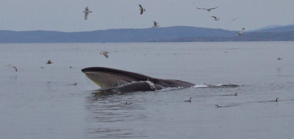
Right at the southern edge of Ireland, in the open expanses of the Celtic Sea, lives the second largest animal that ever existed on our planet. Here the fin whale (Balaeonoptera physalus) thrives, feeding on herring and sprat among other species. It grows to about 20m in length, weighs between 50 and 70 tons, and its blow can extend over six metres into the air. Only the blue whale is larger.

But it is only very recently that we have become fully aware of the presence of these giants off our south coast. The reason we’ve only heard about them recently, however, is quite simple - the experts have only really become aware of their presence recently too. It was in 1999 that Padraig Whooley, a cetacean enthusiast and currently sightings co-ordinator for the Irish Whale & Dolphin Group, moved to west Cork and began to look for whales from the Old Head of Kinsale. He soon realised that west Cork is, as he describes it, a “mecca for whalewatching”.

Zoologist Dr Simon Berrow, the IWDG’s founder and current co-ordinator, explains: “After Padraig started doing the whale-watches we realised that a pattern was emerging and that the fin whales were coming back year after year. We realised that this was a regular thing and not just a once-off.”

West Cork quickly gained prominence among cetacean (whale and dolphin) enthusiasts, with common and bottlenose dolphins, minke, humpback, and fin whales all to be seen regularly. It wasn’t long, though, before it became apparent that fin whales weren’t just confined to the waters of west Cork. “Our original thinking was that they were just off Cork, then it became the whole south coast, and then it became the south west too,” says Berrow.

Indeed, a quick glance at ISCOPE, a powerful digital tool on the IWDG’s website that allows users to generate maps of species sightings off the Irish coast over any time frame, brings up a huge cluster for fin whales over west Cork, with smaller clusters over east Cork and Waterford, and some scattered dots around Kerry.

Padraig Whooley laughs at his own explanation for the distribution of sightings: “I think it's very much the case that the distribution of sightings reflects the distribution of whalewatchers.” Whooley has spent many days at sea off west Cork recently, camera in hand, as he attempts to photographically catalogue the fin whale population. To date, 29 individuals have been identified, using natural physical markings such as patches of discolouration, nicks on their fins, or scars. “We’ve only touched the surface. There are lots more out there that we haven’t photographed,” he says.

Fin whales – close relatives of other giants such as blue and sei whales - are distributed worldwide, but tend to be less common in polar and tropical waters. They can be spotted off our south coast for almost ten months of the year, generally occurring in small feeding groups of three to eight. They are usually first seen in the waters of the south west in late May or June, persisting right through until February, with their distribution seeming to move eastwards towards Waterford and Wexford when they leave west Cork in December. “When we stop seeing them in west Cork, they start picking them off Ardmore head in Waterford,” Whooley says.

According to Berrow, the explanation for this is simple – they are following their food. “We're pretty confident that the individuals we see in west Cork are the same individuals that are seen further east in Waterford and Wexford. This pretty much mirrors what we know about herring, which spawn in the west earlier and in the east later. And as the herring spawning progresses east, the whales seem to move east too.”

Fin whales usually disappear from our coastal waters early in spring, prompting what remains the most enduring question surrounding their behaviour in Irish waters: Where exactly do they go? The truth is nobody really knows.

The migration of fin whales is generally quite poorly understood. Some textbooks will tell you that they make annual migrations from warm, low latitude breeding and calving grounds to colder, higher latitude feeding waters, as is conventional for many large cetaceans. If this is the rule, however, the Celtic Sea population could be the exception.

Berrow elaborates: “There are only two to three months of the year that they're not in Irish coastal waters. In fact, I'd be surprised if they went all the way out of Irish waters at all, given the time frame. Historically a lot were caught off Spain, so they could be going there to calve, but we haven't seen many fins with calves in Irish waters. One suggestion is that these could be immature individuals just hanging around for a few years before they go off to mate, but some of them are very, very big, and don’t look immature. We’re really not sure.”

To answer the questions that surround the movement and migration of fin whales in the Celtic Sea, the IWDG hopes to tag individuals for satellite tracking. “We want to tag five or six because some tags might fail to transmit. The tags work for about 100 days. I think they’ll show the whales following the fish eastwards along the south coast, and then we’ll get to see where they go when they move offshore,” Berrow explains.

finwhalebeached

finwhalebeached

Apart from their migration, there is another major question mark surrounding these animals – just why did it take us so long to realise they were here? Even though concerted whalewatching efforts only began in 1999, surely fishermen, yachtsmen, and seaside locals would have noticed these 20m titans and their giant blows sooner? Dr Berrow thinks that they might actually be relatively new arrivals to our south coast. “We've spoken to fishermen and farmers in the area, and I get the impression that maybe they (fin whales) weren't around so much in the past. Maybe it's because they were hunted so intensely, and what we're seeing now is an increase in population after protection was introduced,” he says.

Past locations of whaling stations and old sighting records don’t point to a long established Celtic Sea population. “The old whaling stations in Ireland were along the west coast. The one in Mayo was located there, for example, because it's the closest point to the shelf edge, which we know oceanic Atlantic fin whales migrate along.  The odd fin whale was caught in the 1700s, but mainly around Donegal, but there are no historical records of them off the south coast. So this habitat could be relatively recent,” Berrow explains.

In the past, fins were a major target for whalers. Initially, they were simply too fast for fishermen, as despite their massive size, they are among the ocean’s fastest swimmers, and can travel at speeds of up to 22 knots (40km per hour). But in the nineteenth century the invention of the steamship and explosive harpoon made them easier prey. Fin whales catches increased through the nineteenth and early twentieth century, and by the 1950s and 1960s around 30,000 were being caught annually, most in the southern hemisphere. Around 600 were landed at the Norwegian whaling station at Inishkea, Co. Mayo. Padraig Whooley thinks fins were “probably the mainstay” of the whaling industry off the west coast.

But if their appearance in the Celtic Sea is part of a global ‘bounce’ in their numbers, just how many were in the north Atlantic before whaling began? There is considerable debate over the figures.  Estimates based on ships’ logbooks have put the number at between 30,000 and 50,000, about the size of the current population. A recent estimate based on new genetic methods, however, suggests the figure could be far higher.

Researchers in the US examined samples of mitochondrial DNA from north Atlantic fin whales and humpback whales, and compared the genetic “distance” between these two species of the same family. Then, they measured the genetic diversity within the fin whale population. By doing so, they were able to calculate how many breeding females would have been required to account for the genetic variation they found, and thus they could estimate population size. They concluded that there were once a staggering 350,000 fin whales in the north Atlantic.

Critics of this study have pointed out that this could have been the maximum size of the population at any point in history, and that the reduction to their current numbers might have been caused by natural factors over hundreds of thousands of years, long before whaling began.

Nonetheless, fin whale populations do appear to be recovering towards pre-whaling numbers, and Dr Simon Berrow believes the Celtic Sea would present an ideal habitat for recovering populations to colonise.  “They could be colonising a new habitat here along the south coast. The waters there are very different to what they used to be. There is massive productivity down there now that’s associated with the changing climate, with massive blooms of phytoplankton. It could be these oceanographic factors that have brought them here now,” Berrow says.

As news of the Celtic Sea’s fin whale population has spread, a fledgling whalewatching industry has sprung up in recent years. Currently, there are two operators running whalewatching tours from west Cork, with more expected to join them soon.  Whalewatching has the potential to be of massive benefit to local communities, and can provide a viable and sustainable alternative to fishing, but Whooley stresses the need for it to be done the right way.

“Here in West Cork the whalewatching industry is gaining momentum, but we need to try and avoid a situation which has too many operators working in the same waters, as concentrations of tourist boats may well have a detrimental impact.”

He continues: “Apart from the demise of salmon stocks, the second biggest threat to killer whales near Victoria (British Colombia, Canada) is commercial whalewatching. Research has shown that killer whales spend less time in the areas where commercial whalewatching boats operate, and that they also dive more and dive deeper and longer here. I don't think we're anywhere near that stage yet, but it does seem that whales have a preference for water where is no pressure. Of course if a fin whale doesn't want you around it will lose you remarkably quickly. It can dive for fifteen to twenty minutes and resurface a mile away. But that said, fin whales shouldn't have to go out of their way to avoid whalewatching boats.”

A policy document produced by the IWDG providing guidelines to marine wildlife tour operators has since been given legal status by the National Parks & Wildlife Service and the Marine Safety Directorate. The document sets out a variety of regulations, such as the speed whalewatching boats can travel at, how close they can approach whales and how long they can spend with them.

Simon Berrow believes there is “huge potential” for marine wildlife tourism in Ireland, citing Scotland as an example of a country that has successfully developed such an industry. Berrow would like to see a whole ecosystem approach taken in the management of the whales in Irish waters: “I spent a few years working in the Antarctic, and there, when they’re setting quotas for the krill catch, they don t just take into account the sustainability of the krill population, but also the amount of krill needed by predators. This isn't really in the mindset in the North Atlantic. The whole push should be on ecosystem management.”

West Cork and the south coast is now quickly gaining a reputation as one of the premier whalewatching spots not just in Europe, but in the world. Whooley recalls a recent day at sea when he encountered harbour porpoises, common dolphins, minke and fin whales. “You could have whale-watched anywhere in the world on the same day and you wouldn't have seen the same diversity,” he says. And if this is a haven for cetaceans, fin whales are certainly the jewel in its crown. But with pressure on these behemoths likely to grow as the area becomes more popular with tourists and enthusiasts alike, Whooley stresses the importance of ensuring adequate protection is in place. Especially when, as he says “so little is known about the ecology or behaviour of these fin whales in Irish waters.”

The website of the Irish Whale & Dolphin Group provides up-to-date news and records of whale and dolphin sightings and strandings, as well as information on whalewatching, IWDG events and courses, and species profiles. It can be found at www.iwdg.ie.

Channel 4 produced an excellent documentary about the fin whale that beached at Courtmacherry, Co Cork in 2009. Watch it here.