Walking up an appetite

Walking up an appetite

The best Irish walks with good food at the end

Irish Times, Saturday, May 4, 2019

Keane’s Bar of Maam in Connemara is a rather singular place known to many walkers in the west. The allure of its roaring fire and cheese toasties is so strong that, when planning walks, I often find myself subconsciously choosing hills and trails within an easy radius of the place. Or even making a detour when I’m not that close.

Read More

A Connemara island on the first day of spring

A Connemara island on the first day of spring

Luibin Garumna is a new trail that explores this less-visited Gaeltacht region 

Irish Times, March 7, 2018

In my mind the real Connemara is not to be found on the tour-bus routes that pass Killary Harbour or Kylemore Abbey, but in places like Ceantar na hOileán, the archipelago of Gaeltacht islands in the south-west of the region. 

Far from tourist hotspots, devoid of iconic mountains, and at the end of a road that leads nowhere, na hOileán is a densely populated and thriving Gaeltacht with a strange landscape all of its own. A new looped walk explores the largest of the islands here, Garumna. 

Read More

A wood in winter

A wood in winter

Rosscahill Woods in Galway are little-known, but together with nearby Brigit’s Garden, make for a fine day out

Irish Times, January 24, 2018

For anyone traveling west towards the mountains of Connemara, Ross Lake near Moycullen is an early sign of the wildness beyond. Coming from Galway City, the lake catches your eye with its thickly wooded shore, and the striking lime façade of the towering manor on its north bank.  

Most walkers drive on to the hills and coast further west. But the forest on the western shore of the lake makes for a fine short ramble, and on a cold day in early winter we walked here under mercurial skies. 

Read More

Follow the song of the paddle

Follow the song of the paddle

Lenny Antonelli spends a slow weekend exploring the Barrow valley on a canoe-camping trip

Irish Times, August 26, 2017

The canoe might be the finest vessel ever built for the traveller. In a canoe you can explore slowly and intently, just like walking or cycling, but from the water you see everything from a new perspective. The landscape takes on a certain freshness.

My first trip in a Canadian-style open canoe was on the Royal Canal in 2015, paddling slowly from Enfield to Mullingar over three days. Then I canoed the Barrow and Upper Lough Erne, each time camping along the way. In July of this year, I returned to the Barrow, the best of Ireland’s big rivers.

Read More

Land of shade and shadow

Land of shade and shadow

This corner of the Burren is full of ambiguity, writes Lenny Antonelli

Irish Times, June 7, 2017

The Irish uplands are often a study of definites, in open spaces and hard borders. Desolate mountains stretch into the distance. Dark blocks of spruces end abruptly at fences. Drystone walls enclose green fields perfectly.

But one particular corner of the Burren is full of ambiguity. The area around Mullaghmore, in the south-east Burren, is an amorphous place where grasslands, turloughs, scrub and woods shift and dissolve into one another.

I am drawn back here over and over. And on a grey, tepid day in early May I set out to undertake a grand traverse of this region, following the Burren Way with two friends.

Read More

Lush woods and open heath above Bantry Bay

Lush woods and open heath above Bantry Bay

This short, rugged trail follows in the footsteps of a pioneering Irish botanist

Irish Times, March 29, 2017 

In just a few short kilometres this fine little trail near Glengarriff explores lush woods and open heath high above Bantry Bay. The trailhead is beside a fine old bridge over the Coomhola River.

With your back to the mapboard, go left until you see the trail beside a house on your right, heading into the woods. You follow this hazel-lined path into a dark, damp forest rich in mosses and ferns.

Keep your eyes peeled for the blue arrows of the Coorycommane Loop as they guide you through the trees, eventually bringing you out to a muddy lane lined with brambles, gorse and pine. You are also following the yellow waymarkers of the Beara Way here.

Read More

Hit your peak on home turf

Hit your peak on home turf

For a few brief weeks each winter, if the weather is just right, eager climbers grab their ice axes and crampons and head for the high, snowy peaks of… Kerry? Lenny Antonelli spends a cold day learning snow and ice climbing on Ireland’s highest mountain 

Sunday Times, March 5, 2017 

Even in Ireland, winter can bring a deep freeze to the mountains. It might seem balmy at sea level, but up in the hills you can find yourself walking through deep snow and surrounded by thick cloud. If you love hillwalking, this is an exciting time, as the mountains you know and love are transformed into strange, snowy landscapes. 

This is prime time for winter mountaineering, Irish style — ice axe, crampons and all. Which is what I was doing meeting mountain guide Piaras Kelly of Kerry Climbing, and a group of eager climbers, on a dark January morning at Cronin’s Yard, the traditional start point for ascents of Carrauntoohil. Through the dim light I could just about make out the snow-capped ridges of the MacGillycuddy’s Reeks above us. 

Read More

'A difficult place for the mind to grasp': walking the Indreabhán bog

'A difficult place for the mind to grasp': walking the Indreabhán bog

Irish Times, February 11, 2017

The vast bogs that lie just west of Galway city are a difficult place for the mind to grasp. Beyond here is Connemara, a region that – while its borders are vague – at least has a coastline, mountains and villages that give it some sense of structure and definition.

But between Galway and Connemara is an empty and nameless space, where few people ramble. In my adolescence, I would often cycle the mountain road here between Moycullen and Spiddal, and stare into these featureless plains, dumbfounded.

But these spaces have gradually been rationalised and civilised over the years. First by the arrival of forestry – there are big plantations here – and now by the development of wind farms rising on once empty horizons. The wild bog north of Indreabhán is one of the few untouched parts of this peatland, and from the coast road, long boreens stretch high into the bog.

Read More

'What it lacks in length, it makes up with spirit': walking the Avonmore River

'What it lacks in length, it makes up with spirit': walking the Avonmore River

A new trail in Co Wicklow explores one of Ireland’s most spectacular rivers

Irish Times, July 27, 2016

The Avonmore in Co Wicklow makes a case for being one of Ireland’s great rivers. What it lacks in length and volume, it makes up with sheer spirit, flowing wide and quick from Lough Dan to the point where it meets the Avonbeg, below Rathdrum. Together they form the Avoca. A new trail launched in April, the Avonmore Way, explores this wooded valley.

I walked it southward on a hot June day. From Trooperstown Forest (just outside Laragh), cross the bridge at the back of the car park and go right at the junction. Soon you pick up the waymarkers for the Avonmore Way as you climb through Scots Pines. In the summer heat, botanical life seemed to sprout from every crevice: bracken and gorse, hawthorn and birch, rowan and wildflowers blooming in any open space.

Read More

The wild streets of Galway

The wild streets of Galway

Take an urban safari on the city's waterways

Irish Times, February 22, 2015

I know few betters ways to see wildlife in Ireland than to walk Galway’s inner bay, and waterways. Start from the aquarium in Salthill and follow the prom towards the city. For me, Galway Bay seems most vital on calm autumn evenings, when the syrup-still water shakes with life as mackerel chase sprat inshore, while seals and gulls stalk the frenzy.

The prom brings you to Grattan Beach, where I’ve found everything from cuttlefish to sea stars to small conger eels in tidepools. Past here, you can walk the causeway out to Mutton Island, under an amphitheatre of mercurial light and weather. But don’t venture out here in high winds or very high tides. The causeway was the first place I saw an otter: when I approached at dusk, a lone walker, it slinked from the road into the sea and was gone.

Read More

Walking with the tides

Time your visit to this mysterious tidal island with care

Irish Times, 10 January 2015

For years, Omey Island seemed a near-mythical place to me. Despite exploring much of the Connemara coast I had never been to this tidal island, which you can walk to at low water but which becomes cut off at high tide. Inishbofin, Inishark and Inishturk print their silhouettes indelibly on the western skyline, but Omey hides away under the Aughrus Peninsula.

You can cross the wide strand from Claddaghduff Quay to Omey around low water from roughly half-tide to half-tide. But tidal conditions vary each day, and with the weather, so ask in Sweeney’s shop and pub in Claddaghduff for local advice before setting out.

We crossed Omey Strand an hour before low tide one gusty October day, roughly following a route described in Paul Phelan’s book Connemara and Mayo: A Walking Guide (Collins Press, 2012). Rather than follow the signposts all the way over the strand, this route veers right towards a prominent house near the island’s northeastern corner.

As we crossed the beach, a hearse started out across the hard sands, followed by cars. The burial procession advanced slowly through the grey wind, bound for Omey’s graveyard.

As you reach Omey, turn right and follow the shore, passing the graveyard if you haven’t already. Ignore the sandy road leading inland towards the house and continue along the beach. You can now pick up a sandy track above the curving shoreline and follow the northern coast (no fence-hopping required).

You will come to one beach, then another. Where a fence turns inland above the second beach, follow it to the remains of Teampall Féichín. This medieval church was built on the site of an earlier monastic settlement founded by St Féichín. Omey’s Gaelic name is Iomaidh Féichín, the bed of Féichín.

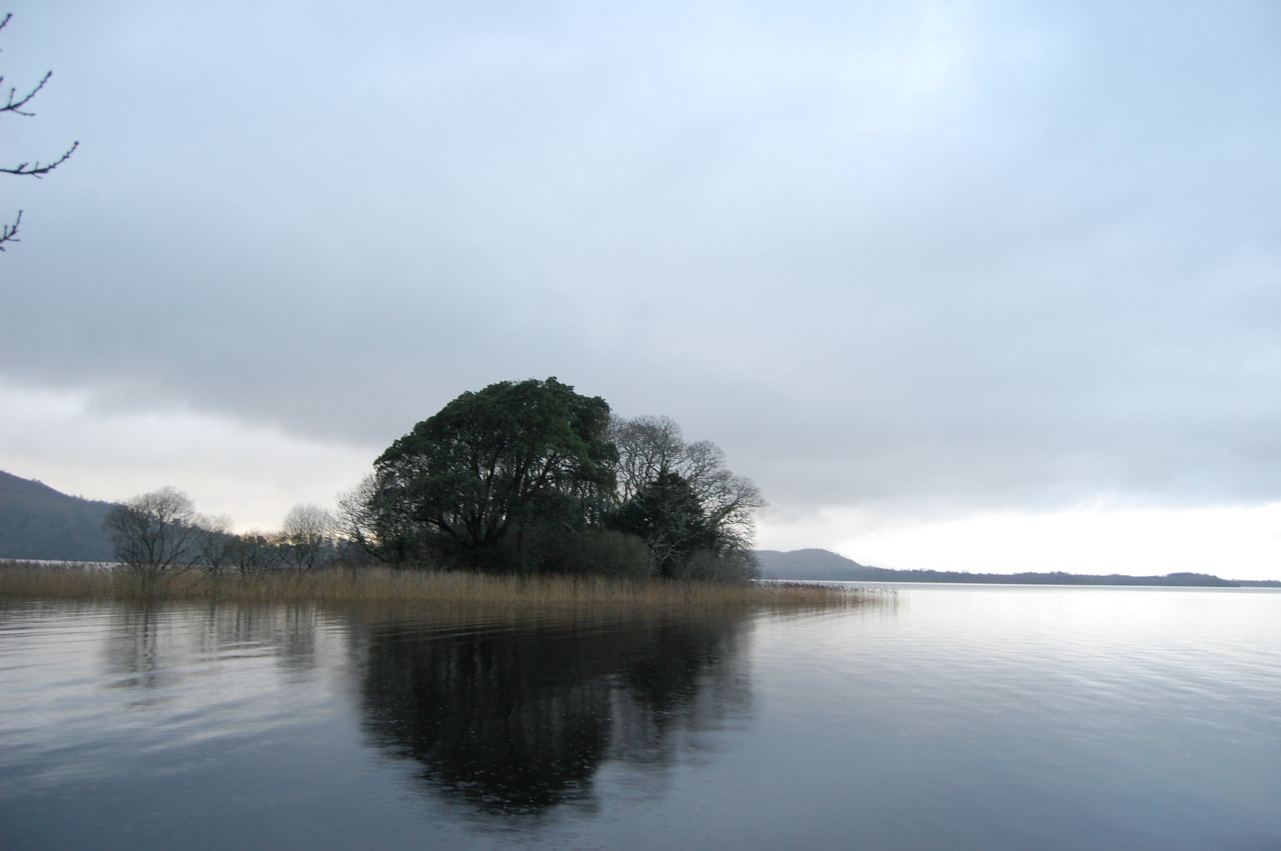
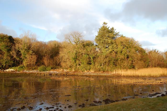
Return to the beach and continue to follow the shore. This exposed corner of the island is called Guairín, meaning small dunes, according to Tim Robinson’s book Connemara: The Last Pool of Darkness, from which I have gleaned much of my information. It is mostly machair, a sandy grassland only found in western Ireland and Scotland. The grass is populated by snails that use the lime-rich sands to build their shells.

You will reach the island’s northwest corner, where there is another small tidal island offshore, and, further west, Cruagh Island. Follow the shore of Omey as it turns and heads southeast.

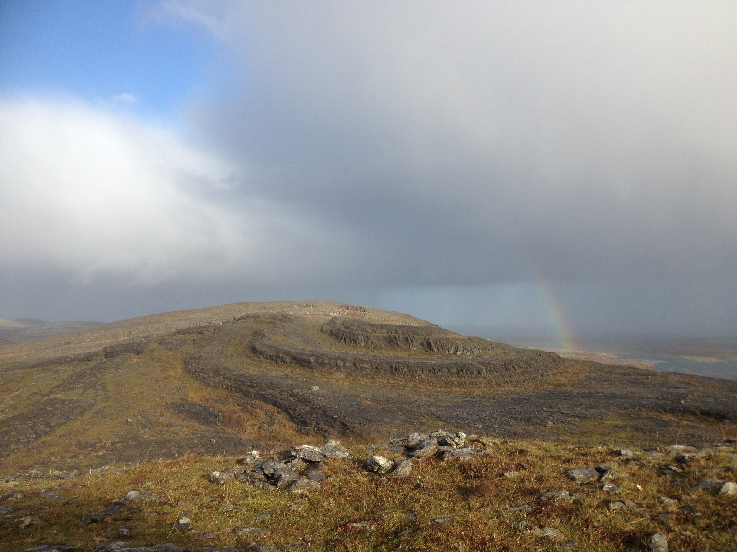
The wind was heavy and the sky grey – not a solid grey, but a fluid mass of moving shades and shapes. To the south, towards Slyne Head, the dim sunlight broke through in crepuscular rays. Keep the sea on your right until you come to a small bay. St Féichín’s well, where pilgrims have left strange trinkets, is above the shore here.

In 1841, Omey was home to 396 people; just 10 years later, after the Famine, this had almost halved. The island’s school closed in 1973, and today there is just one year-round resident.

Cross the beach, join the road by two mobile homes and go left, past the lake and back down to Omey Strand. Presuming you haven’t horribly miscalculated the tides, you can follow the posts back across the sand to Claddaghduff.

WALK: OMEY ISLAND, CO GALWAY

Map: OSI, Discovery Series Sheet 37.

Start/finish: Claddaghduff Quay, Co Galway. The turn for Claddaghduff and Omey is about 3.5km north of Clifden on the N59. Turn at Claddaghduff church for the quay, or continue straight for Sweeney’s shop/pub.

Time and distance: Roughly 8km, 2.5 to 3 hours.

Suitability: Easy to moderate walking. Head out well before low tide. Omey has no services.

Secrets of Slieve Bloom

Walk in a wooded valley in the Slieve Bloom mountains

Irish Times, 30 August, 2014

An experienced hillwalker once told me that his least favourite range was the Slieve Bloom mountains of Laois and Offaly. I can’t recall his reasoning, but I imagine it might have been that it’s boggy and fairly flat, with no soaring peaks, and covered in forestry.

But the Slieve Blooms hide glorious secrets. Having lots of wooded rivers in one small range is invigorating, and you can explore one of these by walking the Brittas loop at Clonaslee, Co Laois.

The Slieve Blooms were behind a wall of mist when I approached, after heavy showers soaked the midlands. From the trailhead, the blue markers followed a track into woods along the river, where there was plenty of hazel, beech, ash, and Douglas fir.

These woods are part of the old Brittas estate, held by MP Francis Plunkett Dunne, who built nearby Brittas House in 1869. The Dunnes were said to be descendants of the legendary high king of Ireland, Cathair Mór.

The trail passes an old weir and the ruins of an old bridge. You will pass new footbridges too, but stay on the right bank as the trail goes through a series of stiles. After a while the track climbs away from the river, leaves the wood and joins a grassy lane between two fields.

Hints of autumn were everywhere: blackberries ripening, bracken beginning to rust and birch leaves yellowing. The boreen emerges to a road, where the trail turns right, then immediately left into more woods of beech and holly.

The path brings you to Brittas lake, built as a reservoir for the old estate, with water pumped up from the Clodiagh river. There are picnic benches and old fishing stands.

Beside the lake is a grove of Scots pine, a graceful tree rooted deeply in Ireland’s ecological past. This species once thrived on Ireland’s uplands and marginal habitats, but was pushed out as the climate grew wetter, bogs expanded and early farmers cleared the land. It may have survived in isolated refuges. But most Scots pine across the country today is from Scottish stock.

The waymarkers at Brittas lake are a little confusing, but essentially they direct you to lap the lake fully. As you leave the lake behind, rather than turn left down the path you came from through the woods, continue straight to some barriers, and go left.

There was once a large oak forest here, and you can see old oaks along the track. When you reach a fork, follow the waymarker right. A bit further on, you swing left where a grassy track leads off to the right.

Here a fallow deer and her fawn stood on the path ahead of me. I expected them to bolt, but the mother strayed into the woods, leaving the youngster behind to stare dumbly at me. I moved closer, until the mother returned and both deer darted. The route then crosses straight over a forest road and onto a grassy lane. Where a fallen tree blocks the path, circle around it to the left. The path emerges through an old gate of the Brittas estate to the west side of Clonaslee village.

From here you can continue straight on past some houses to reach the crossroads, where you turn right for the trailhead to complete the loop.

Map: OSI Discovery Series Sheet 54, or download from coillteoutdoors.ie. Start/finish: Clonaslee, Co Laois, 14.5km west of Mountmellick on the R422. From the crossroads by MD Hickey’s pub, take the road south along Clodiagh river, towards the mountains. Trailhead is on your left. Time and distance: 8km, 2 to 2.5 hours, not including breaks. Suitability: Graded moderate. Trail follows woodland trails, forest tracks and farmland lanes. Some parts are wet and muddy.

Land of woods and water

Walk the woodlands and turloughs of little-known Garryland

Irish Times, 28 June, 2014

You’ve probably heard of Coole Park, the former home of Lady Gregory and setting of famous WB Yeats poems. But you might not have heard of Garryland, which is where Yeats’s hipster cousin might have hung out: it’s just around the corner but way less visited and that much harder to find.

The whole interconnected Coole-Garryland complex must be one of Ireland’s richest nature reserves, with 400 hectares of woodland, turlough, limestone pavement and grassland. But the Garryland side sees little footfall compared to Coole.

Leaving the Garryland car park, the woods along the trail are rich with hazel and ash. These trees are often found together on limestone, and they thrive here on the lowlands east of the Burren.

I recently heard a local farmer say that there’s no place on earth like the Burren in spring and, though you’re not really in the heart of the Burren here, you can sense its presence in the trees, wildflowers and rock.

The old building beside the trail, just after you enter the wood, is used as a summer roost by more than 60 lesser horseshoe bats. Close by there’s also a specially built hibernaculum, an underground chamber for the bats to hibernate in during winter.

We took a side-trail and followed it to a dead end, then continued on a rougher track into the woods. We startled two hares from the path and they hopped off, bouncing noisily through the undergrowth. All along, the trails were spotted with the scat of pine marten.

The air was so warm and sticky that Garryland felt more like primordial jungle than an Irish woodland: bugs attacked my neck, the air was thick and humid, and the wind dropped to nothing.

Later we took a side path down to the dry grassy bed of a turlough. These “disappearing lakes”, fed by groundwater during wet weather, are interwoven with the forests here, stretching their watery fingers deep into the woods. There’s nowhere else in Ireland where turloughs are so intimately associated with old woodland.

We passed a grove of oaks and one old yew, then rested on a rock in a clearing. “It looks like something out of Jurassic Park,” my walking buddy said, staring at the scene in front of us: a small turlough, surrounded by a grassy savannah that was dotted with boulders. I could see what she meant: it looked so green and primeval that we half expected Brontosaurus to emerge from behind the hawthorns.

But when the turloughs rise in wet weather, the trails flood. You probably won’t get far if you come here in mid winter, so visit in summer during a dry spell.

The full linear walk from the Garryland car park to Coole is almost 5km one-way, and you could make this much longer by exploring different side paths. This is what makes Coole-Garryland so special: there are few other places in Ireland where you can spend so long walking through woodland (unless you like walking in circles).

But the swampiness of the day seemed to call for a lazier approach. After resting we turned back, then took a different trail to another turlough fringed by steep limestone crags. Tired and thirsty, we walked back to the car park in the still May heat.

Go Walk: Garryland Woods

Map: OSI Discovery Series Sheet 52 covers the area but may not show trail details.

Start and finish: Garryland Woods car park. From Gort take the R460 towards Corofin, but turn right for Kinvara almost 1km after crossing over the motorway. Follow this minor road for 2.5km and take the first right. The car park is 1.5km up on your right hand side. Room for only a few cars.

Time and distance: My walk was 7km / 2 hours with breaks, but this can easily be made longer or shorter such is the variety of trails.

Suitability: The main paths are flat and easy, but side trails can be rougher. Go during dry weather in summer as the trails flood in wet weather / winter.

Info: Coole Park Visitor Centre (www.coolepark.ie).

Services: There are seasonal tea rooms at Coole Park and full services in Gort.

Through the heartlands

Walking the Grand Canal Way across the bogs of Offaly

Irish Times, 26 April 2014

I left Tullamore on a proper Irish spring morning: icy wind on my face, warm sun on my back. My plan was to follow the Grand Canal Way west through the boggy heart of the midlands.

Just outside Tullamore the canal passes Shra Castle, built in 1588 by an English solider who married into a local family. But Ballycowan Castle, a bit further on, is even more striking.

Nearby the towpath crosses two aqueducts, engineering marvels that lift one waterway above another. Further on I spotted a peacock butterfly, my first of the year, its rusted wings spotted black, cream and lilac. The countryside here was flat and farmed. Some fields were wonderfully disordered, with overgrown hedgerows and rough grass. Others were smooth and symmetrical, their hedges hacked bare.

Seeing this, I thought of an eccentric landowner in the midlands who once who told me that when walking his land, I would know where his farm ended because the fields would suddenly become boring. He celebrated disorder, and I imagined him cursing the neatest fields beside the canal.

Later I was resting by a bog oak sculpture at Pollagh when a barge named the Cheerful Lady passed. She had left Tullamore when I did, but had fallen behind me waiting at a lock. “Maybe if you get tired they’ll give you a lift,” the man from Waterways Ireland had said. The barge and I exchanged pole position a few times until she pulled ahead at Pollagh, and that was the last time I saw her.

Past Pollagh the towpath vegetation was stripped bare, and I had to trudge through peaty mud. The Grand Canal Way stretches from west Dublin to the Shannon, and is marked along its whole length. The walking is flat, but in places the towpath is rough and muddy, so wear good walking shoes. Though this section follows quiet roads in parts, I encountered few cars. Make sure you stick with the waymarkers – if you walk on the opposite bank, you could find yourself hitting a dead end.

Then the land grew wilder, and the blooming gorse gave away its secret: I had entered bog country, where the canal passes through Bord na Móna’s great cutaway peatlands. The houses disappeared, and the land between towpath and bog filled with a hodgepodge of scrub, wood and field, more interesting that any single habitat. Nearby are the Turraun Wetlands, created when Bord na Móna flooded its exhausted peat fields. They form one section of Lough Boora Parklands, 2,000 hectares of cutaway bog where nature has retaken hold to create lakes, meadows, scrub and woodland. The parklands have walking trails, hides for birdwatching, bike hire and angling lakes.

Along the canal the towpath crosses one of Bord na Móna’s bog railways. Nearby something big seemed to tumble into the canal from the reeds. I scanned the water for an otter’s head, but none appeared. Later I watched a heron stalk fish from the towpath.

Early in the evening, I left the canal at Gallen and walked 2km by road into Ferbane. I had just enough time for a tipple before catching a bus out of the bog country.

Map: Trail maps at irishtrails.ie. OSI Discovery Series maps 48 & 47. Start: Bridge over the canal at the end of Colmcille Street ( a continuation of High Street & Bridge Street), Tullamore. Start on north side of the canal. Finish: Armstrong/Gallen Bridge, 2km south of Ferbane. Time & distance: 26.2km on the canal, plus 2km into Ferbane, took me 7.5 hours at brisk pace. But leave 10 hours of daylight for safety. Those preferring a shorter walk could tackle a stage: Tullamore to Pollagh (15.6km) or Pollagh to Armstrong/Gallen Bridge (10.6km).

The colourful and the curious

Step into the exotic at Massey's Wood

Irish Times, 22 March 2014

Heading through Dublin’s southern suburbs towards the mountains, I’m always buoyed by how quickly city turns to country. My curiosity piques as housing estates fade into small fields, wooded lanes and ramshackle farmyards.

Massy’s Estate lies just beyond the reach of the city, south of Rathfarnham. From the outside it appears a typical wood, but look closer and you’ll find something much more exotic.

I arrived on a February afternoon to hike the trail that follows the Owendoher River through the forest. In the 1930s, trees from Europe, North America and Asia were planted here. Plaques mark many of these specimens, and we tried to determine each tree’s identity before arriving underneath it.

My guesses were almost always wrong, but in my defence I had never seen a Bhutan pine or West Himalayan spruce before. There are western hemlock, cedars, limes and giant sequoia here too.

The exotic trees and infesting rhododendron make Massy’s feel almost sub-tropical. This was once the site of a grand estate, of which there’s evidence all around: stone bridges, garden walls, an ice-house where lamb was stored.

According to Frank Tracy’s book If Those Trees Could Speak, the estate collapsed due to the extravagant lifestyle of the sixth Baron Massy. In 1924 his grandson Hamon Massy was evicted from Killakee House and deposited by the road on his mattress.

The family later moved into a gate lodge on the estate, and Hamon was often seen walking in the woods thereafter. Killakee House was knocked in 1941. Part of the original military road, built by the British in 1803 for quick access to the Wicklow uplands, runs through the grounds.

The Owendoher is a glorious little river, dropping through a long series of falls, pools, and riffles. In 1931, the gardaí found a secret IRA weapons stash on its banks. The elaborate, booby-trapped bunker held a tent, bedding, tinned food, and a supply of rifles, revolvers and explosives.

The riverside trail looked short on our map but was tougher than we expected, climbing about 200 metres over its course. The wood narrows at its upper reaches, bordered by fields and farmyards. From here we looked out over the city, and tried to pick out urban landmarks through the pale afternoon mist.

Up here, high and unsheltered, the wind whipped into the woods, and we had to navigate around pines that had been torn up and dumped across the trail.

At the top of the wood, we turned back, and downhill we crossed the river and joined the nature trail. The Dublin Mountains Partnership has published an activity book for the trail on its website. But our legs were weary, and once someone ventured the notion of tea, we were making our way back to the car park before the light faded.

Map: OSI Discovery Series Sheet 50. Maps at dublinmountains.ie. Start and finish: Hell Fire Club car park, R115. Exit car park on foot, turn left and the entrance is 100m on. Note car park hours. Time and distance: Our route combined the Riverside Trail (white markers) and Nature Trail (orange): 7.5km/2hrs 30mins. Suitability: Won’t trouble experienced walkers; trails may be muddy and blocked by fallen trees. Deer culling may be taking place, heed safety notices.

A tale of two lakes

Walk the Sligo Way through woods, hills and lakeshore

Irish Times, January 25 2014

Hiding between the wild coastlands of Mayo and Donegal, Sligo’s landscape is less dramatic but more lush and green. Benbulbin draws most of the county’s plaudits, so other hills are forgotten. The 78km Sligo Way traverses the county’s less trodden, boggy uplands. I wanted to spend a day exploring it, so headed for the village of Collooney.  From here the trail follows the Owenmore and Ballysadare rivers into Union Wood, where old oaks and mossy crags sit uncomfortably beside spruce plantations. Further east it crosses the high heathlands of Slieve Daeane.

I had feared a dull slog over this hill but instead found real drama at Lough Lumann, a mountain lake with a backdrop of tall heather-coated crags. Showers passed over and mist erased the summit. This is the best kind of hill weather, an interplay of sun, cloud and rain that changes the light and landscape with each moment.

It’s impossible to write about Sligo without reference to Yeats, whose words have become a filter through which we see the county. He wrote “we should make poems on the familiar landscapes we love, not the strange and rare and glittering scenes we wonder at”.

According to John Cowell’s book Sligo: Land of Yeats’ Desire, a chamber tomb near the summit of Slieve Daeane is known as Cailleach Beare’s house. In a note to his poem The Hosting of the Sidhe, Yeats explains that Cailleach was a fairy who “went all over the world seeking a lake deep enough to drown her faery life . . . until, at last, she found the deepest water in the world in little Lough Ia” on top of this hill. But this lake’s name wasn’t on my OS map.

After coming off Slieve Daeane, the trail enters Slish Wood and follows a stream toward the shore of Lough Gill. Yeats was inspired by Walden, Henry David Thoreau’s classic account of life in the Massachusetts woods, to spend a night sleeping here. “I planned to live some day in a cottage on a little island called Innisfree, and Innisfree was opposite Slish Wood where I meant to sleep,” he wrote. He spent a night under the trees, but barely slept for fear of being discovered by the wood-ranger. “However, I could watch my island in the early dawn and notice the order of the cries of the birds.”

If anybody lived here like Thoreau, it was Beezie Gallagher, who was born on the lake’s Cottage Island and later returned to live there, rowing into Sligo regularly. She hand-fed birds and squirrels inside her cottage, and banned a visitor who threw stones at rats. She was rescued after a blizzard in 1947, then in her 80s, but rowed back to her island home after a week of recuperation. She died there in a fire in 1951.

Leaving the forest, the trail crosses rough bogland and woods before emerging to a slipway that looks out on Inishfree, the end point of my walk through Yeats country.

Map: OSI Discovery Series sheet 25. Maps at irishtrails.ie. Route: Marked by yellow arrows, description at sligowalks. ie. West of Slieve Daeane above the tree line a waymarker has fallen over – the trail continues under the power lines. Forestry operations at Balleygawley Woods may mean this section is closed over the next two or three weeks. Suitability: Moderate for hillwalkers,tough trail crosses remote upland, lots of boggy ground. Distances: Collooney to R284/ Ballygawley Woods: 6km. Ballygawley Woods to Slish Wood: 9km. Slish Wood to Inishfree car park: 5km

Take a lazy winter walk

A ramble around the woods and shoreline west of Galway City

Irish Times, December 28, 2013

If you’re like me, the idea of hillwalking the day after Christmas festivities is a tough proposition: my legs are leaden and I am in danger of dozing off mid-walk. Perhaps this time of year lends itself more to sauntering than hiking.

Living in Galway, one of best spots for lazy walking is around Barna Woods and Lough Rusheen, just west of the city. Here the city’s suburban fringe meets its best fragments of wild land. Over a few square kilometres, there’s woodland, grassland, streams, salt marsh, beaches, rocky shore and glacial cliffs.

Every town has somewhere like this – a rich, wild place that’s overlooked purely because it’s so close to traffic and housing estates.

Barna Woods and Rusheen reward those who pay the closest attention. Near the entrance to the woods, for example, is a holy well, where St Enda is said to have rested for a night before travelling to the Aran Islands in the 5th century.

I went walking here the morning after violent winds had cut up the west coast. Huge trunks lay violently severed on the forest floor: had these been fresh victims of the previous night’s storm?

The wind had calmed, but frequent passing squalls showered the woods with hailstones and sent me scurrying helplessly under leafless branches.

The chaotic weather made for a beguiling mix of colours: blue skies, deep grey clouds, green ivy and holly, and the white of hailstones on golden leaf litter. Heavy rain gave momentum to tiny streams, turning them into little cascades of white water.

I remember picking raspberries in these woods as a teenager, but despite searching for the plant many times since, I’ve yet to find it again.

After exploring the woods, head across the coast road to Lough Rusheen park on the edge of Rusheen Bay, a wide and muddy flatland that fills and empties with the tide. Migrating sea trout and salmon pass through here on their way to the Atlantic from the Barna stream, which rises in the bogs west of Galway city and flows into this little bay.

Rusheen is a great spot to indulge in some bird watching, that wonderful activity that starts when you stop walking altogether, and just sit and stare.

Local bird expert Tom Cuffe says the bay’s finest spectacle occurs at the end of summer, when hundreds of migrating sandwich terns gather before flying south to Africa. At this time of year you’ll find wintering curlew, widgeon, teal, grey plover, dunlin and more.

One of Galway’s best keep secrets is the small woodland reserve that Birdwatch Ireland own on the edge of the bay, which was the last stop on my morning ramble.

As I left the wood towards a backdrop of housing estates and the sound of traffic, I watched two farmers in the adjacent field roll out hay for their cattle, one last rural routine surviving in suburban Galway.

BARNA WOODS/LOUGH RUSHEEN

Start and finish: 7km west of Galway city centre on the R336 coast road towards Spiddal, there are car parks for Lough Rusheen (left) and Barna Woods (right) just after a petrol station. Birdwatch Ireland’s reserve is down a turn towards Rusheen Bay Windsurfing about 1km towards Galway City (not much room to park). Suitability: Easy, but bring waterproof footwear.

More than a rocky place

Exploring the trails in the Burren National Park

Irish Times, November 16, 2013

Words such as barren and bleak are used to describe the Burren so often, you could be fooled into believing them. Sure the region’s limestone plains can feel desolate, but on a bright day the Burren proliferates colour: silver rock, lime valleys, turquoise water. That’s before you add the summer orchids and wildflowers. And if you walk the Burren National Park you’ll see a rich mix of habitats – woodland, meadow, pavement, scrub, lake, fen. Early in November I cycled from Gort with the intention of climbing Mullaghmore, the hill that dominates the park. Then I got lost on the way and found myself pressed for time. The area’s web of boreens is gloriously bewildering. But if you see the Craggy Island parochial house you’re in the right vicinity – the house filmed for Father Ted is just down the road here.

When I arrived, I took the orange trail to Knockaunroe turlough. Virtually unique to Ireland, turloughs are lakes fed by groundwater during rainy periods, but they disappear in dry weather. I found a crevice where water seemed to bubble up from the limestone.

The word Burren comes from the Irish boireann, meaning a rocky place. The exposed limestone soaks up heat in summer and releases it in winter, making the growing season unusually long – one reason cattle are brought to the Burren uplands in winter.

Later I walked the nature trail through meadows, wood and limestone pavement. The hazel and ash woodlands may be stunted and fragmented but they are thick and lush, dripping with moss, ferns and lichen. The sun warmed my back, the trees blocked the wind, while bees and midges buzzed around: it could have been high summer if it wasn’t for the rusting bracken and yellowing hazel. I reached a slab of limestone and spotted fossilised corals in the rock. “Each fragment of the Burren is a mausoleum, each hill a necropolis of unthinkable dimensions, containing more dead organisms than there are humans who have ever lived,” Robert MacFarlane wrote in The Wild Places, his account of exploring the untamed landscapes of the UK and Ireland.

Mullaghmore was sometimes visible above the scrub. This hill doesn’t break 200m, but it offers one of Ireland’s most intoxicating vistas. Experienced walkers can tackle the looped trail that visits the summit. But even if you don’t aim for the top, you can still follow the markers as far as Lough Gealáin.

But I didn’t have time, so I followed the trail to the Knockaunroe turlough one more time under greying skies.

Start/finish: Mullaghmore/Gortlecka Crossroads. From Corofin, Co Clare take the R476 to Kilnaboy and turn right on to the L1112 before the ruined church. After about 4.5km you’ll reach a trailhead/car park before the crossroads. Suitability: The Orange Route (Knockaunroe Turlough) and Green Arrow Route (Nature Trail) are graded Moderate. Blue Route (Mullaghmore Loop) is graded Very Difficult, includes some light scrambling and enters remote uplands. Treat it as a full hill-walk with map, compass and full hiking gear needed. Time & distance: Orange Route -1.3km/30mins. Green Arrow Route - 1.5km/40mins. Blue Route - 7.5km/3hrs. Map: OSI Discovery Series maps 51& 52 cover the national park. Services: Corofin, Gort. No facilities at the park itself. Further info: burrennationalpark.ie/trails. The park visitor centre in Corofin opens in summer and runs free guided walks, talks and a bus service to the park.

The Banks of the Boyne

A long stroll beside one of Ireland's most legendary rivers

Irish Times, Oct 19, 2013

photo: una mcmahon

photo: una mcmahon

Walking a riverbank gives you new perspective on a landscape. While climbing a mountain opens the land up around you, walking a quiet waterway hides you from the world. The river becomes your own private highway through the countryside. Was any Irish river historically more important than the Boyne?

Ancient landmarks line this valley: Newgrange, Knowth, Dowth, Trim Castle, the site of the Battle of the Boyne, the Hill of Tara.

We set out from the car park in Navan and followed the old towpath. Canals were built along the river between 1748 and 1800 to make it navigable for trade. Barges carried grain, coal, flour and other goods between riverside mills and the port at Drogheda.

Pleasure boating later became popular, but the waterway succumbed to competition from roads and rail and grew derelict. An Taisce acquired the navigation in 1969, and its seaward end is now being restored.

Above us the sky was heavy with cloud and the forecast was for rain. But the autumn light was clear and liquid, and the landscape full of colour.

The towpath was lined with tall mixed woodland. Autumn leaves were turning yellow and orange as chlorophyll broke down and other pigments took over. Some ash leaves were lemon yellow, and tall gnarled oaks were laden with acorns. We saw a heron fishing by a weir, and watched a moorhen take cover in canal-side vegetation.

I had only come from Galway, but the change in landscape felt dramatic. The trees were taller and stouter here, the fields wider and greener, their boundaries composed of shrubs rather than stone. The land seemed more colourful, though less wild.

My walking buddy picked up horse-chestnut seeds from the towpath, and we went over the rules of conkers to affirm we still knew how to play. “We used to paint them with nail varnish,” she said – to make them stronger in battle, naturally.

We stopped by the ruins of a lock, bridge and cottage. We passed the impressive red-brick manor of Ardmulchan Demesne, the ruins of Dunmoe Castle – which Cromwell’s forces are said to have fired a cannon ball at – and medieval Ardmulchan church and cemetery.

I knew it was unlikely, but I daydreamed that we might see someone rowing a Boyne currach down the river. Unique to this waterway, these ancient oval vessels were made from woven hazel rods and animal hide. Local artist and currach builder Claidhbh Ó Gibne is now helping to revive this craft. He’s building a 36ft version that he plans to sail from Spain to Ireland to mimic the journey of the ancient Celts.

Soon we arrived at six-arched Broadboyne Bridge – an information panel told us it was once customary to bring cattle across the river nearby to ward off fairies and certain diseases.

Then the rain arrived. We sat under a tree and ate lunch, then turned around for the long walk back to Navan in the fresh autumn drizzle.

GO WALK: BOYNE RAMPARTS WALK, NAVAN Start & Finish: Ramparts car park, Navan, just outside the town centre on the R153. If you have two cars you could finish at the car park/trailhead by Broadboyne/Stackallen Bridge rather than return to Navan.Distance: 16km (8km if going one-way).Map: OSI Discovery Series Sheet 42Suitability: Easy, flat path but there are no facilities or escape points along the way.

Restorative ramble

A stroll through one of Co Dublin’s oldest woodlands

Irish Times, Sept 14, 2013

There’s so little old woodland in Ireland it feels like an exotic habitat. Trees once covered our island, but today walking in woods is a novelty compared to walking on hills, beaches or bog. I was browsing a study of ancient Irish woodlands recently, hoping to discover those last places this primeval landscape survives and came across one listing for Dublin: St Catherine’s Wood, Lucan.

One Sunday evening in late July, I caught a train from Connolly station to Leixlip Confey and walked to St Catherine’s. The sun was coming out after a heavy downpour and a rainbow formed over a field where highland cattle grazed. This hardy, mountainous breed was introduced here last year to improve meadow biodiversity. The cattle will graze and trample some parts of the field more than others, encouraging a wider range of plants to grow.

The old wood is just inside the Dublin county border. St Catherine’s gets its name from a priory founded by Warisius de Pech here in 1219. At the time it was considered the duty of Anglo-Norman lords to establish religious foundations to save their souls and those of their ancestors.

Over the centuries the estate passed between different owners. Trinity College pharmacy professor Christopher O’Connor owned the lands in the 1940s and 1950s. He grew exotic plants such as poppies, carnations and deadly nightshade, which were sent to a pharmaceutical plant in Tipperary, according to an article by local historian Mary Mulhall in the Lucan Newsletter in 2012.

The OPW bought the estate in 1996.

My walking buddy and I followed the path into the woods which sit on a steep glacial ridge above the Liffey. The canopy here is dominated by ash and beech. The latter was introduced to Ireland in the 16th century. There’s plenty of sycamore here too, but only the odd oak.

Some rare woodland plants recorded at St Catherine’s suggest this wood may be ancient. The naturalist Robert Lloyd Praeger found the yellowbird’s nest plant here in 1934, although it hasn’t been seen since. More recently the common toothwort was recorded.

We took a side trail down to the remains of an old sluice gate, where the Liffey is squeezed through a narrow gap in a torrent of whitewater. A kayaker was play- boating in the rapids. We startled a heron on the riverbank and watched a woodpigeon drink from the water.

Then we rejoined the main path and climbed to the upper woodland, following the trail back towards the cattle field and out of the woods.

Our stroll left me thinking that even though there are too few of them in Ireland, woodland walks always provide the most restorative kind of ramble.

Robert Louis Stevenson, in one of this travel essays, wrote: “It is not so much for its beauty that the forest makes a claim upon men’s hearts, as for that subtle something, that quality of the air, that emanation from the old trees, that so wonderfully changes and renews a weary spirit.”