Untamed Achill
/ From the Irish Times, 31 March, 2012
LENNY ANTONELLI takes a clifftop walk in one of the country’s wildest corners on Achill
ACHILL’S BEEN in the news so much for developer Joe McNamara’s Stonehenge imitation it’s easy to forget the wildest thing about the island isn’t the planning, but the intoxicating landscape. The most untamed terrain here is the island’s western corner, which wowed the English travel writer J Harris Stone in 1906 with its “sheer frowning precipices, no less than two thousand feet in height, and chaotically disarranged boulders of giant proportions, round which the Atlantic rollers fume and smoke”.
I set out from Keem strand, a sheltered cove with blue-green waters surrounded by steep hills, and the likely setting of Paul Henry’s painting Launching the Currach. Above the beach lie the remains of Captain Charles Boycott’s estate. When his house here was burned down, he built another on the opposite side of Croaghaun mountain. The remains of an altar where Catholic priests said secret Mass during penal times are here too.
From the car park, hike the steep 200m to the second World War lookout on the hill above. The climb is tough, but it’s the most challenging part of an otherwise moderate walk. You’ll be greeted on top by the jagged Benmore cliffs that drop into the Atlantic below.
Keem Bay was home to a major basking shark fishery between 1950 and 1975. A lookout would stalk the sharks from the headland, directing fisherman in their currachs who would sneak up on the giants of the ocean and kill them with the jab of a lance behind the head. The fishery landed more than 12,000 of the species between 1950 and 1975.

Heading away from Keem, follow the line of cliffs towards Achill Head, the island’s western tip. Some faint trails have been etched out, but they can be tricky to follow. The cliff edge overhangs in places too, so keep well back, perhaps following the intermittent sod barrier.
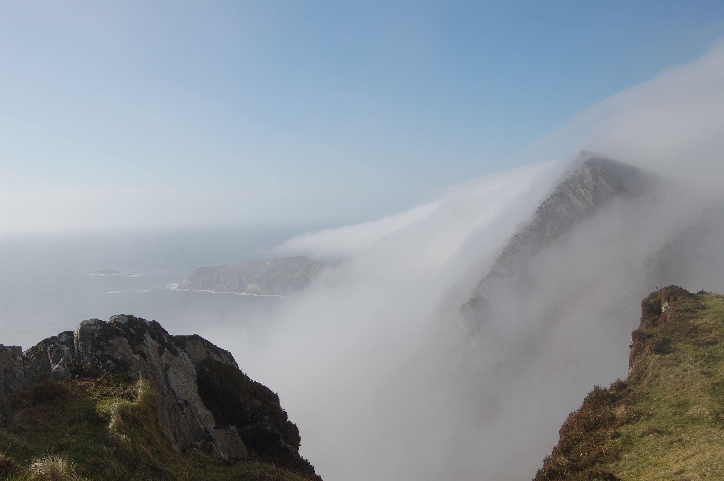
Perched on a clifftop above the empty Atlantic on the edge of Europe, the weather here can change in moments. As I walked along, mist rapidly rose up and over the cliffs, fogging up the valley below. Pick a clear day to tackle this one.
As you near the back of the island, the vastness of the landscape reveals itself. The cliffs below stretch a mile out to Achill Head. The empty valley lies pockmarked with lakes and, on the other side, Croaghaun drops 688m into the sea, making it three times higher than the Cliffs of Moher and one of Europe’s highest sea cliffs. The Mullet Peninsula lies to the northeast, with Clare Island, Inishturk and the mountains of Mayo and Galway to the south.
Make a gradual descent to the stone ruins on the valley floor. These are the remains of the deserted booley village of Bunowna, a summer settlement for herders who would bring their livestock here to graze. The terrain here is wet and boggy, so cross the valley and make your way back to Keem on higher ground. The isolation is splendid; just over an hour from the car park, you find yourself in one of Ireland’s wildest spots.
As I neared Keem, mist descended on the valley. Sheep appeared and quickly disappeared in the fog, and I heard ravens circling overhead. Suddenly, four birds swooped in front of me, crossing the valley, before the fog consumed them again as I made the final descent back to the beach.
Start and finish: Car park at Keem strand. To get to Achill, follow signs to Newport from either Westport or Castlebar. From Newport take the N59 to Mulranny, then take the R319 all the way to Keem at the western end of Achill, passing through the villages of Achill Sound, Keel and Dooagh.
Time: 2-3 hours.
Distance: 7km.
Map: Ordnance Survey Discovery Series, sheet 30.
Suitability: Moderate. By far the most challenging part of the walk is the initial steep climb to the clifftop.
Good boots and waterproofs are essential though, as the terrain can be very boggy, particular on the valley floor, and the weather can change quickly, with strong winds and fog posing obvious risks. Watch your footing closely on the cliffs.
Food and services: Shops, pubs and accommodation in Dooagh and Keel villages.
Further information: achilltourism.com/hillwalking
